Overview
Vanishing Clouds: Colombia's Hidden Páramo Crisis is an interactive web atlas documenting the accelerating decline of Colombia's páramo ecosystems — the high-altitude tropical wetlands that supply drinking water to 48 million people, host over 500 endemic species, and represent more than 70% of the world's páramos. The atlas is organized into six thematic modules: Páramos, Build a Páramo, Species, Threats, Urgency, and About.
The project's central argument is that Colombia holds an ecosystem that is, in effect, endemic at the landscape scale — not just in its species, but in the very conditions that allow it to exist. The site was designed to guide viewers through a narrative sequence: first understand what a páramo is, then how it forms, what lives there, what threatens it, and why conservation action matters.
"I wanted viewers to understand that the páramo is not just a remote landscape, but a rare ecological system tied to water regulation, biodiversity, and national environmental identity — an ecosystem that is itself almost endemic to Colombia."
Live Interactive Atlas
Embedded below — explore all six modules using the top navigation. Click any green páramo polygon to open its detail card, toggle environmental layers in Build a Páramo, filter species by threat status, and step through land-cover change from 1986 to 2024 in the Threats timeline.
Six Interactive Modules
Each module focuses on one dimension of the páramo — from geography and ecology to biodiversity and human pressure — building toward a composite understanding of why these ecosystems are both extraordinary and urgently at risk.
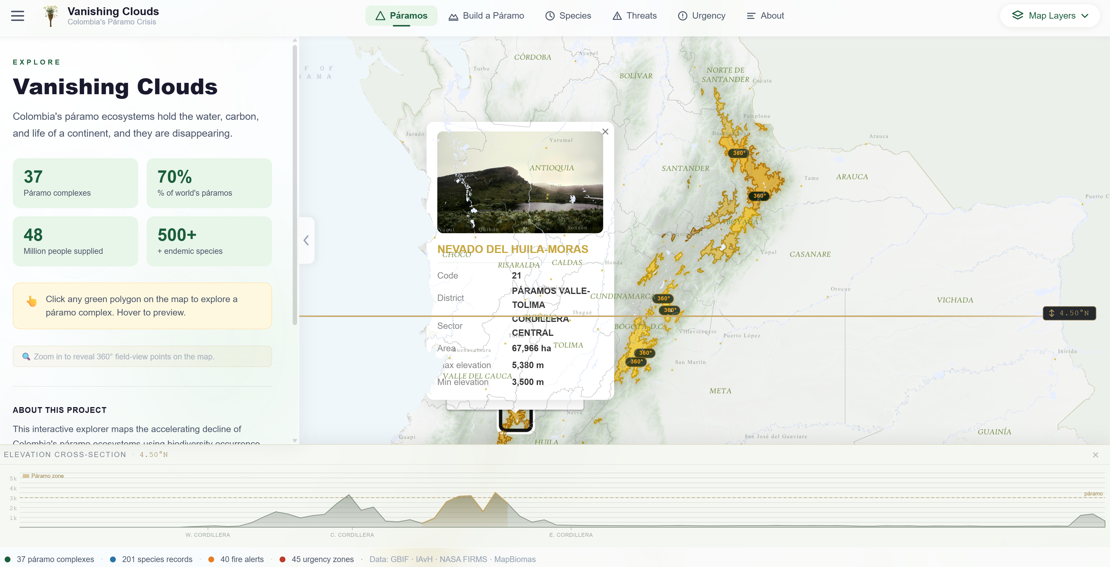
The main view displays all 37 of Colombia's officially recognized páramo complexes as interactive polygons distributed across the three Andean cordilleras. Clicking any complex opens a detail card showing its code, district, biome, surface area, and elevation range.
360° field-view markers appear as users zoom in, revealing georeferenced photographs taken directly inside the páramo. A dynamic elevation cross-section at the bottom of the screen renders the terrain profile at the current latitude in real time.
Páramos don't emerge at random — they require five converging conditions. This module lets users toggle each environmental layer individually and watch the map respond: high elevation (≥2,800m), cold temperatures (2–10°C), abundant moisture, tropical latitude, and Andean geography.
A composite Climate Match Score layer synthesizes temperature and precipitation to show where páramo-like conditions exist globally, revealing that the Colombian Andes are the only place where all factors converge at scale. Pan around the globe to compare.
A hexagonal grid shaded by species richness reveals biodiversity hotspots across Colombia's páramos — darker cells indicate greater species concentration. A temporal slider animates GBIF occurrence records from Pre-1980 through to the present, showing how documentation has grown over decades.
Individual species are filterable by group (Flora / Fauna) and IUCN threat status (CR, EN, VU). Clicking any species entry opens a detail card with a field photograph, taxonomy, year of first record, and geographic coordinates from the GBIF observation database.
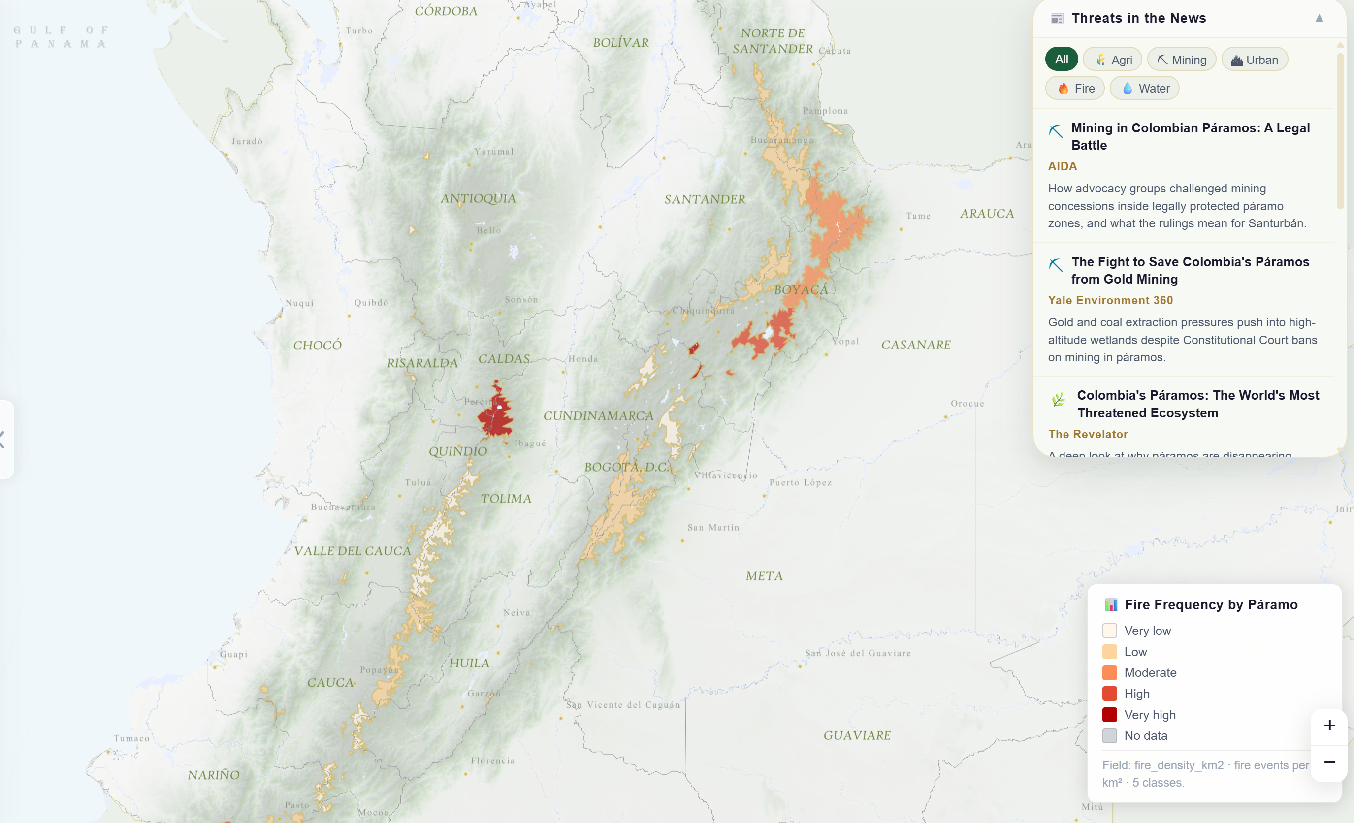
Six threat views expose the human pressures reshaping páramo landscapes from 1986 to 2024, powered by MapBiomas Colombia annual land-cover classifications: a land-cover timeline, threat category by year, agriculture expansion by complex, urban proximity risk, total land-cover change, and fire pressure.
A curated Threats in the News panel surfaces recent journalism from AIDA, Yale Environment 360, and The Revelator — linking the spatial data directly to active legal battles over mining concessions inside constitutionally protected páramo zones.
The Urgency module synthesizes all preceding threat layers — land-cover change, fire pressure, agriculture expansion, and urban proximity — into a single composite conservation urgency index across all 45 urgency zones.
The index is designed to help researchers, policymakers, and the general public quickly identify which páramo complexes face the greatest combination of pressures and therefore represent the highest priority for immediate conservation intervention.
Screenshots
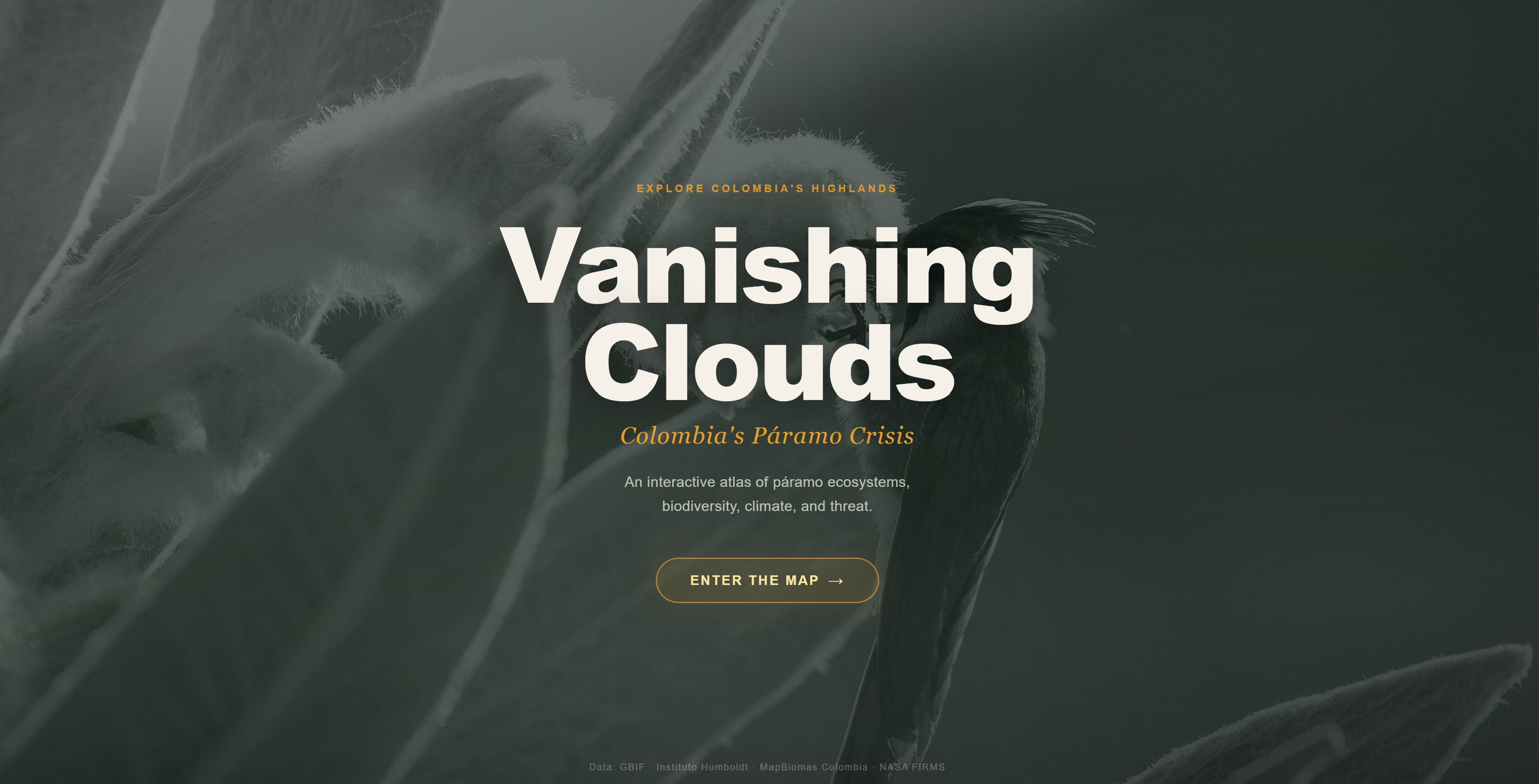
Landing page — cinematic frailejón (Espeletia) hero image with entry button.
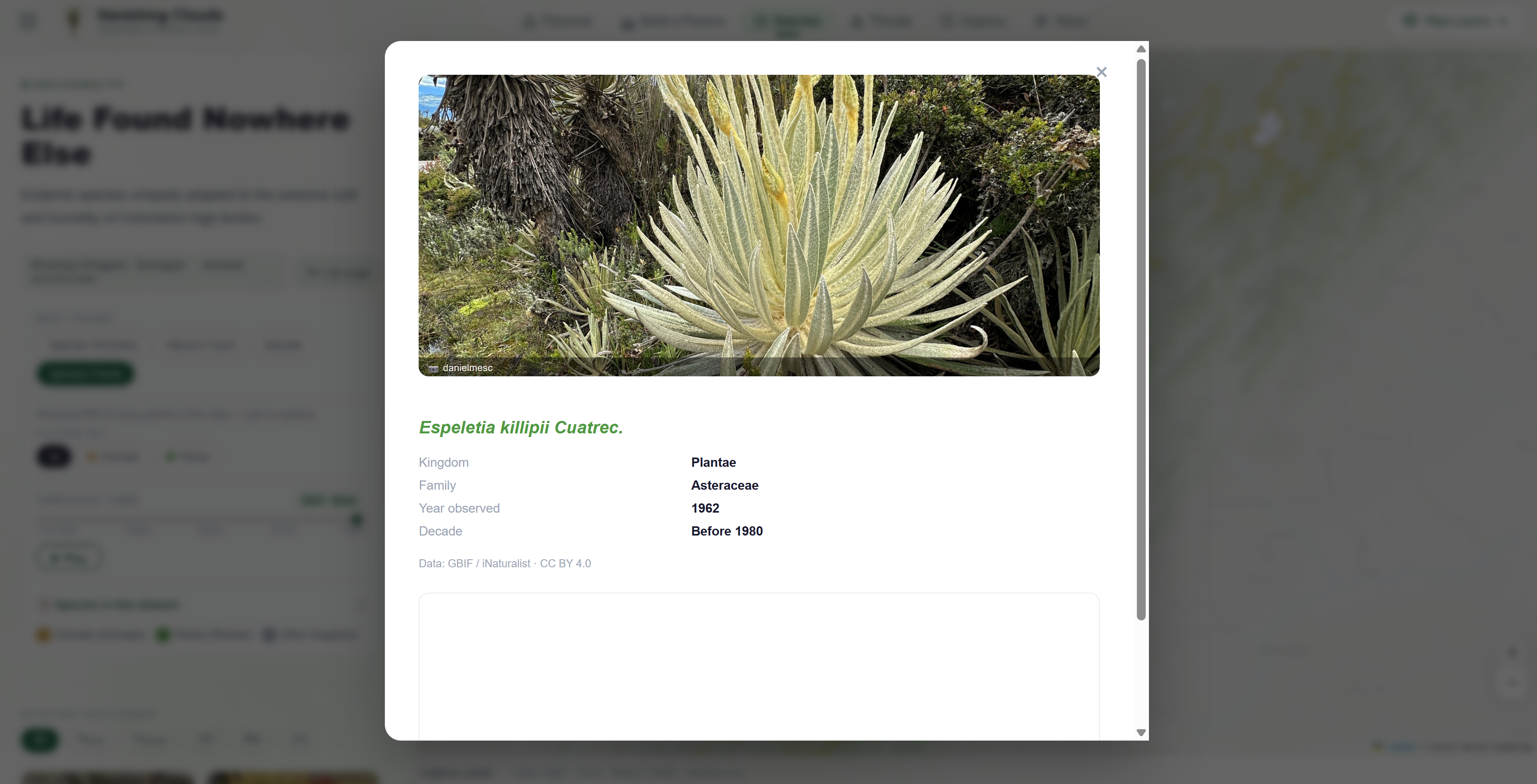
Species card — Espeletia killipii Cuatrec., Asteraceae, first recorded before 1980.
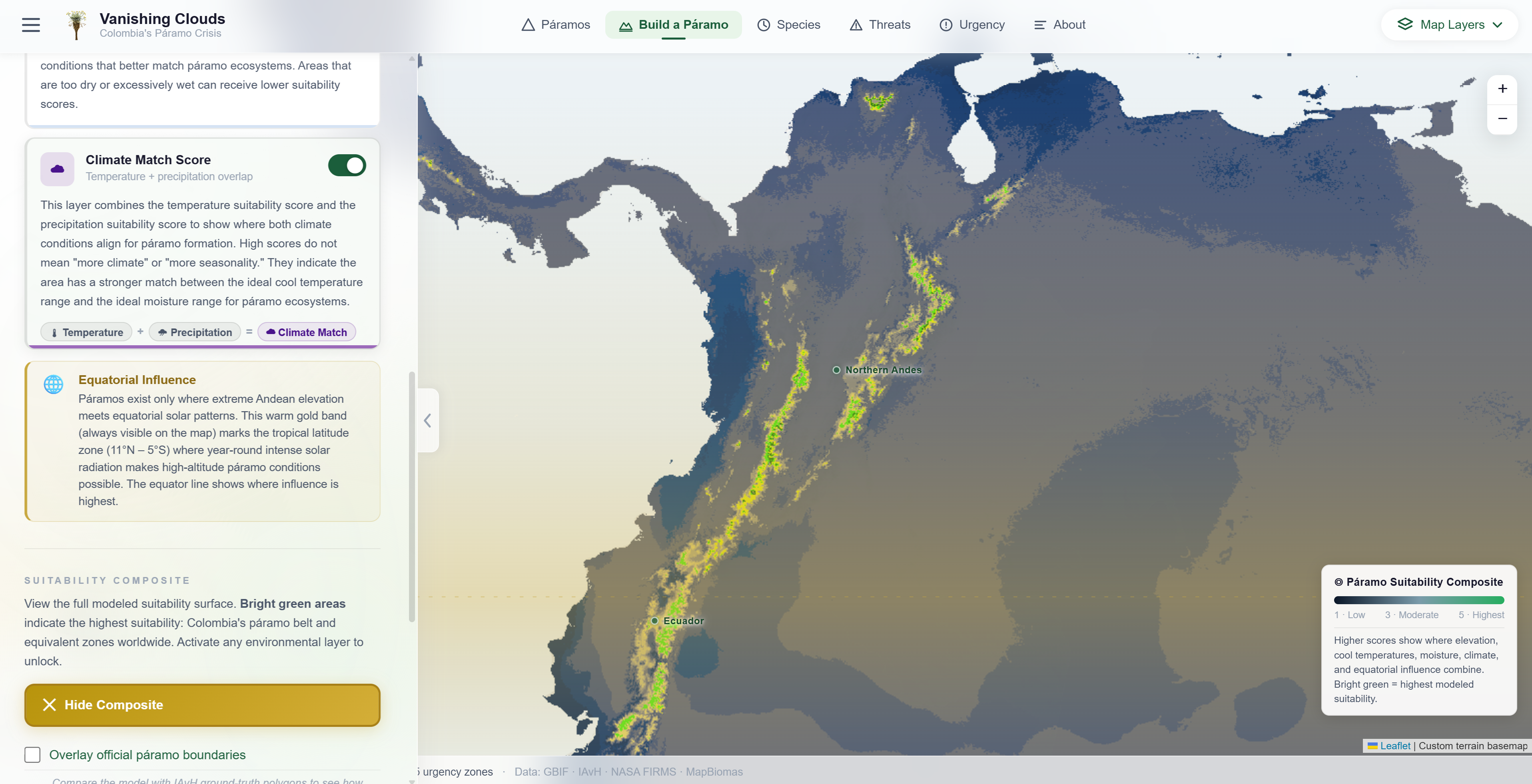
Build a Páramo — global climate suitability composite showing the Colombian Andes as the world's primary páramo belt.
Threats — fire frequency by páramo complex with the Threats in the News journalism sidebar.
Data Sources
| Source | Data Used | Module |
|---|---|---|
| GBIF | Species occurrence records, taxonomy, observation dates | Species |
| iNaturalist | Citizen-science field observations for endemic páramo species | Species |
| Instituto Humboldt (IAvH) | Official páramo complex boundaries, elevation ranges, ecological metadata | Páramos · Urgency |
| MapBiomas Colombia | Annual land-cover classification rasters 1986–2024 | Threats |
| NASA FIRMS | Active fire detection alerts by páramo complex | Threats · Urgency |
| ArcGIS Pro layers | Elevation, climate, and environmental reference layers prepared for web export | Build a Páramo |
Design Decisions
The six modules follow a deliberate arc — geography → formation conditions → biodiversity → threats → urgency — guiding viewers from wonder to concern rather than presenting data without context.
A custom dark terrain basemap anchors the atlas visually, allowing golden páramo polygons, teal biodiversity hexagons, and red fire alerts to read clearly against the mountainous Andean backdrop.
Showing climate suitability at the global scale — not just Colombia — makes the argument for páramo uniqueness spatially rather than textually. Viewers discover for themselves that no other region matches.
Linking spatial data to active legal battles and published journalism grounds the map in real-world consequence, transforming it from a visualization into an advocacy and policy communication tool.
Technical Challenges
- 01 Desktop GIS to web cartography: Many layers that worked well in ArcGIS Pro required significant adaptation for online display. Raster layers needed to be clipped, resampled, or simplified; transparencies adjusted; and in some cases data converted from raster to vector polygon format to work within web-friendly Leaflet.js rendering.
- 02 Multi-format dataset integration: GBIF occurrence records, IAvH boundary shapefiles, MapBiomas annual land-cover rasters, and NASA FIRMS fire data each arrived in different spatial resolutions, coordinate systems, and symbology conventions — requiring a custom preprocessing pipeline to align them into a coherent, consistent web experience.
- 03 Performance at national scale: Displaying 37 páramo polygons alongside hexagonal species grids, annual land-cover timelines, fire alert markers, and an interactive elevation cross-section required careful layer ordering, geometry simplification, and progressive loading strategies to maintain responsiveness across the full extent of Colombia.
This project argues that conservation attention should extend beyond individual endangered species to whole ecosystems whose uniqueness and fragility make them irreplaceable. The páramo is not marginal landscape — it is a concentrated, biologically and hydrologically critical system whose loss would be felt by nearly half of Colombia's population.